Under way
Jocko Valley Canal-to-Pipeline Conversion
Converting aging open canals to buried pipelines to improve delivery efficiency, reduce water loss and modernize irrigation.
- Timeline
- 2025 to 2027
- Program
- Irrigation & Infrastructure
- Location
- Jocko Valley, east of Highway 93 near Arlee
Project overview
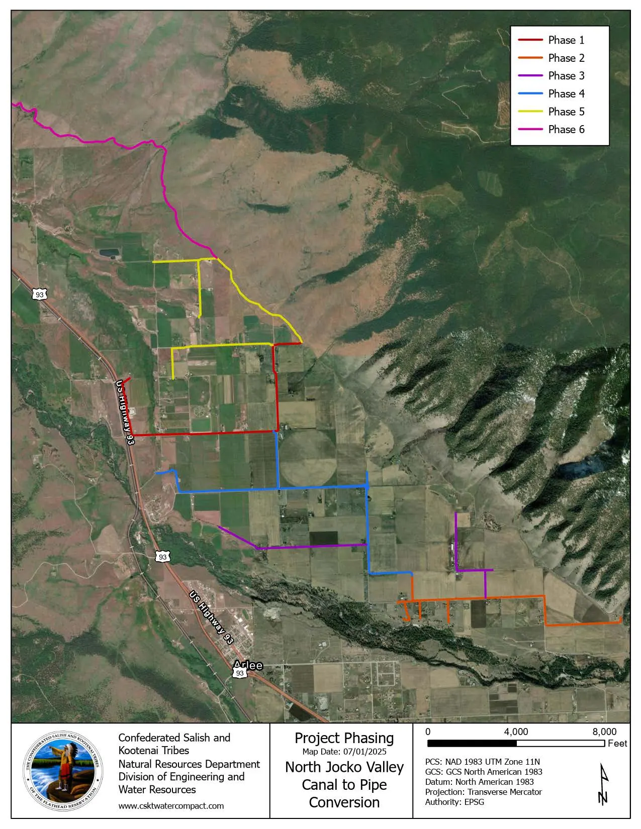
The Jocko Service Area of the Flathead Indian Irrigation Project has been identified as a high-priority target for rehabilitation, betterment and modernization as it relates to water delivery efficiencies. The Jocko K Canal irrigation service area will be rehabilitated with a delivery network of pressurized, buried pipe. Pressurized pipe operates by completely filling the pipe with water, allowing the pipe to pressurize by the effect of gravity. A Master Plan for the area was developed as a collaborative effort between the engineering services of Morrison-Maierle, CSKT, and FIIP staff. The conceptual design is split into six phases over the next few years that will involve 17.7 miles of pipeline. Some of the challenges in the Jocko service area include canals overgrown with vegetation, high seepage, due to the character of underlying soils, and flow control structures.
Where
Construction will occur east of Highway 93 between Oliver Thomas Lane and Sodfarm Road. Please expect construction vehicles and occasional traffic interruption on the following roads:
- Oliver Thomas Lane
- Theresa Adams Lane
- McLeod Road
- Dumontier Road
- White Coyote Road
- Martz Drive
- Scotch Pine Lane
- Lost Horse Lane
Video
Drone footage from DEWR, without narration. New videos with speech would carry captions and transcripts.
StoryMap
Jocko Valley Canal-to-Pipeline Conversion StoryMap
Interactive ArcGIS content from DEWR's GIS team. Loads from arcgis.com.